
Wildfires swept through Sugarloaf Ridge State Park in both 2017 and 2020, each time burning about 75% of the parkland.
Park Overview
Straddling the Mayacamas Mountain Range and overlooking both the Napa and Sonoma Valleys, 4,750-acre Sugarloaf Ridge State Park is known for its breathtaking views. Visitors can enjoy vistas of the San Francisco Bay, Napa, and Sonoma Valleys, and (on clear days) the snowy Sierras. Sugarloaf combines with adjacent Hood Mountain Regional Park to offer nearly 40 miles of trails which can be enjoyed by hiking, biking, and horseback riding. Sugarloaf contains a wide diversity of ecosystems. These include a deep canyon studded with redwoods, a winter waterfall, oak woodlands, meadows, chaparral, and serpentine habitats with rare, often stunted plants.
The Glass Fire
During the Glass fire, Park Staff provided firefighters lots of help. They provided information on the park and surrounding areas, maps, WiFi, and lots of Guayaki Yerba Mate. Sugarloaf Ridge State Park was a major battleground in preventing wildfires driven by October 2020’s hot and dry inland winds from scouring Southern Sonoma Valley. The meadows and basin of the upper park are ideal staging areas for firefighters. They are situated halfway from the valley floor to the ridge top. Existing fire roads within the park provide easy access for fire trucks to connect to other fire roads along the ridge. The presence of firefighters assured the headquarters structures were saved.
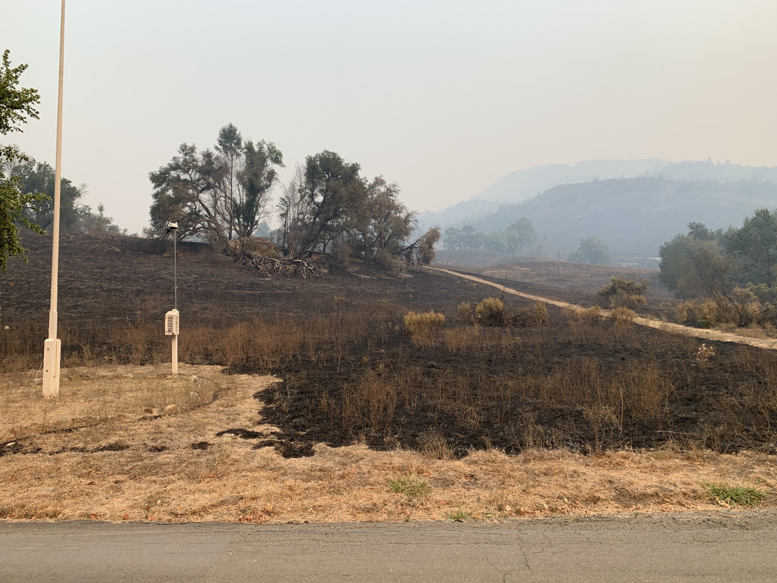
The 2020 Glass Fire originated in northern Napa County. It blew south along the Mayacamas into Sonoma County and burned homes and businesses to about 10 miles north of Sugarloaf near Los Alamos Road. The northern part of Sugarloaf, the McCormick Addition, was burning by 11 p.m. on Sunday, September 27. Luckily, winds coming over bald mountain slowed by Monday morning. CAL FIRE used Adobe Canyon Road, Meadow Trail, and Gray Pine Trail as fire breaks and continued to expand protection with bulldozers throughout Monday afternoon. On Monday night, fire crews lit backfires along the park meadow that burned up Bald and Red Mountain. These fires met to hold the fires creeping downhill from the north.
The Nuns Fire
On the night of October 8, 2017, the Nuns Fire started burning along Sugarloaf Ridge. Four days later, the fires came back to the park just north of the campground, following a slow, downhill burn. On October 14, a hot, fast-moving fire entered the park from Hood Mountain to the West. It consumed four homes and multiple bridges, retaining walls, and steps in its path. CAL FIRE prepared an extensive fire break along the Napa County line to prevent the fire from moving into Napa County.
Fire Recovery
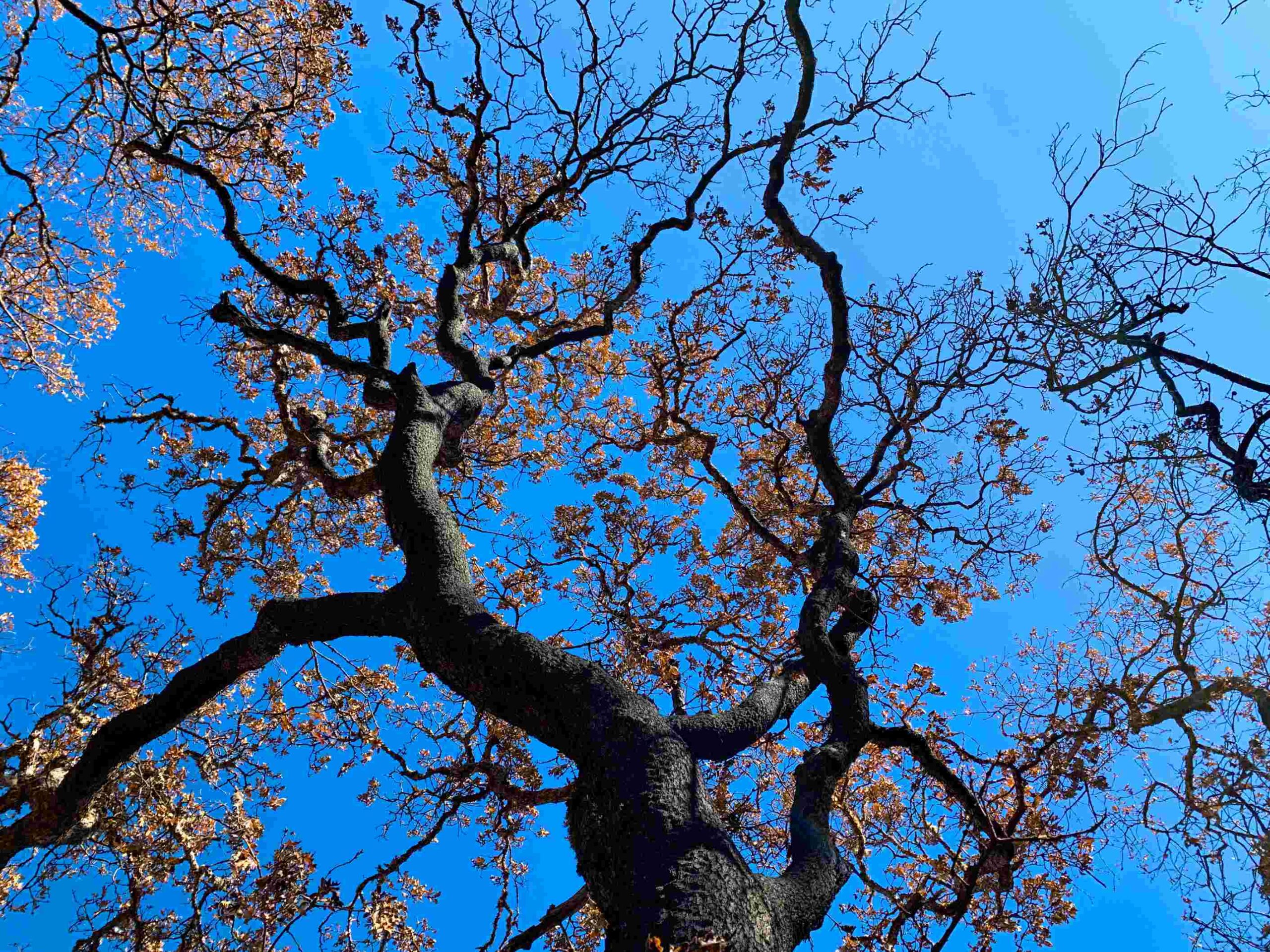
Historically, these natural and working lands regularly experienced fire. This is because Native Americans stewarded Sonoma Valley’s watersheds prior to European colonization using fire as a landscape management tool for millennia. Despite, and perhaps because of, American settlers’ efforts at fire suppression, extreme fires occurred in Sonoma County in 1923 and 1964. These events are comparable in many ways with 2017’s fires. Our local natural history is clearly fire-adapted. Many native plant communities rely upon fire for their continued viability. While many natural and working lands will recover on their own over time, some areas will need active restoration. This includes the investment of resources to prevent the runoff of toxic materials and sediments from contaminating drinking water supplies and sensitive habitats. Also needed are efforts to minimize the threat of flooding, landslides, and other safety hazards. These steps can maximize ecosystem recovery.
Through thoughtful and targeted assessment, planning, permitting, and conservation of fire-prone habitat lands, we can improve the resilience of Sonoma County’s open space lands so that we are better prepared to cope with future wildfires.
Visitors can hike on the Fire Recovery Walk to see firsthand plant life recovering from the 2017 wildfires.